|
|
Rhynie
|
Wheedlemont NJ482262 |
||
|---|---|---|
 |
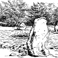
Dominated by the huge hill fort on Tap o' Noth at Rhynie, the westernmost outpost of the Garioch, are many Pictish stones, cairns, smaller forts and the remnants of several stone circles. Rhynie is on the A97 eight miles south of Huntly. Buses are few so it's best to go by car. This area on the edge of the farming lands of Aberdeenshire has been long and continuously inhabited. Going south from the village on the B9002 stop to look at the Craw Stane in a field on the left, and visit the lovely little Norman church at Auchindoir about two miles further on, up a back road to the right (B9002). Built in pink sandstone, on a motte at the edge of a tree-filled gorge, this is a place of great tranquillity. The doorways are Norman arches, one exquisitely decorated with dog's-tooth patterning, supported on either side by delicate columns and capitals. |
|
|
||
|
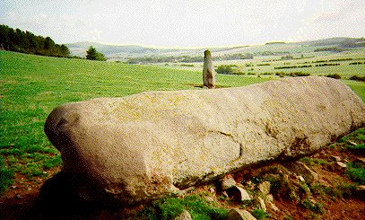
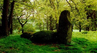
Now, onward into the past. Turn first right, ½ a mile past the church onto the wee road wiggling its way back to Rhynie, a scenic route between little knobbly hills and cow-meadows. Pass the Wheedlemont hill fort, and Templand, a common place name usually meaning a history of Knights Templars, or the old "Druids Temple", in other words a stone circle. There are only a couple of stones left at each of the Wheedlemont circles seen from the right of the road, at Upper Ord from the left, and going back through Rhynie, two more tall stones at Mill of Noth, probably flankers, all visible from the road. |
 |
|
 |
||
Corrstone Wood NJ510271 |
||
|---|---|---|
|
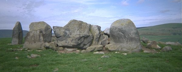
From Rhynie Square go east onto the road towards Druminnor Castle. About ½ a mile on the left is the stone circle in woods on Corrstone Hill. Reach the woods by walking up the edge of the fields; ask for permission at the Mains of Druminnor first. This is a narrow winding road - take care parking. Of this stone circle, only one flanker and the long, broken recumbent stone remain standing. On the west arc of the circle three more stones lie fallen and moss-covered. Old pines, oaks and gnarled rowans grow in and around the circle. The name Corrstone is apt as there are lots of crows in the woods. |
 |
|
Ardlair NJ552279 |
||
|---|---|---|
 |
||
|
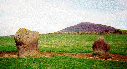
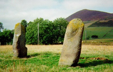
For a contrast there is the circle and Pictish stone at Ardlair on an open, windswept hilltop. Navigate the back roads east to Clatt (three miles). Head for Kennethmont, then turn left (SE) down the road towards Auchleven stopping at Ardlair farm. Ask for permission at the farm to see the circle. Walk up the slope opposite the farm towards a small plantation of trees. The circle is on the right, with its recumbent stone broken and split in past attempts to destroy it by fire. It is thought that it had been re-aligned in prehistoric times to adjust to changing lunar or stellar observations, which makes you think how long this site must have been in use. Four other stones remain standing and there is a superb vista of Tap o' Noth and Dunnideer. See how many hill forts you can find on the map and spot from here. About 200 m to the south-east, over the fence, beside the trees are two stones perhaps part of another circle. On one is a faintly visible Pictish "beastie" and a tuning-fork symbol. |